


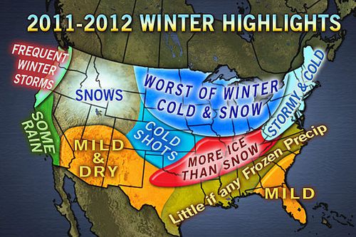
The AccuWeather.com Long-Range Forecasting Team is predicting another brutally cold and snowy winter for a large part of the country, thanks in large part to La Niña... yet again.
La Niña, a phenomenon that occurs when sea surface temperatures across the equatorial central and eastern Pacific are below normal, is what made last year's winter so awful for the Midwest and Northeast. Monster blizzards virtually shut down the cities of New York and Chicago. Last winter was one of New York City's snowiest on record.
La Niñas often produce a volatile weather pattern for the Midwest and Northeast during winter due to the influence they have on the jet stream. The graphic below shows the position the jet stream typically takes over the U.S. during La Niña.
The way the jet stream is expected to be positioned during this winter's La Niña will tend to drive storms through the Midwest and Great Lakes. Last year, the jet stream steered storms farther east along the Northeast coast, hammering the Interstate 95 corridor.
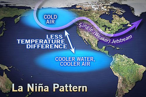
This graphic illustrates the common position the jet stream takes over the United States during La Niña.


